The Port of Naantali takes maritime safety and efficiency to a new level with new intelligent fairway
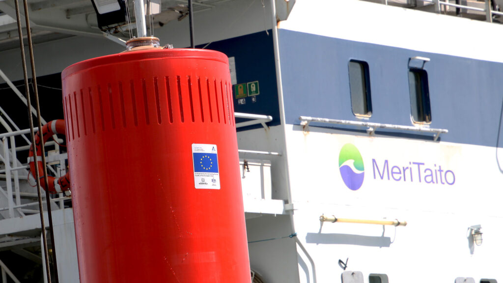 Kuva: Meritaito Oy/Poijun asentaminen 4.5.2020 Photo: Meritaito Ltd./Installation of a new buoy in Naantali, Finland
The Port of Naantali takes maritime safety and efficiency to a new level with new intelligent fairway
Port of Naantali Ltd is participating in the EU-funded project to develop new intelligent fairways with innovative navigation marks, new standardised 3D mapping and automated emissions control solutions for vessel traffic. The project is currently in the phase of piloting new technologies in Naantali with four smart buoys and a specific emission monitoring buoy, placed on the approach channel. Measurements of the seabed and the quays are underway for new chart technology. The technical design and production of the piloted fairway technology is provided by Meritaito Oy, an Arctia Group company.
Shipping industry in digital transformation
All sectors of the shipping industry are undergoing a fundamental change owing to digitalisation. The role of port companies has expanded and includes today not just providing harbour infrastructure but also digital services. The significance of maritime safety and environmental considerations has become ever more heightened in all aspects of port operations. “This project is a prime example of our development enabling us to roll out new technologies at pace while creating foundations for future solutions,” says Yrjö Vainiala, Port Director of Port of Naantali Ltd.
Energy efficient smart buoys are remote controlled
The new digital buoys are connected to a central remote control system through the data network. The luminosity of buoys can be adjusted and their status, such as their position or battery status, can be monitored remotely. Adjusting the luminosity of a buoy is both an energy-saving and safety feature, and the project is also piloting an automated adjustment based on vessel position information (AIS). The monitoring of the status of buoys is particularly important in the spring, when the moving ice masses may move buoys out of their place. Within the harbour area, one of the buoys will be outfitted with instruments measuring the direction and speed of currents and the sealevel to support the safe operation of vessels.
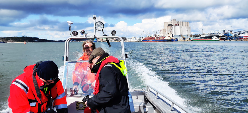
Kuva: Naantalin Satama/Seuraamaan poijun asentamista 4.5.2020 Naantalin Sataman edustalle. Photo: Port of Naantali/ On the way to follow the installation work of the buoy in Naantali area.
The project also involves the piloting of new sustainable energy solutions for aids to navigation such as long-life battery technology and solar panels installed around buoys. Paired with the remote control of the buoy’s status, this will also improve the reliability of the aids.
The Port of Naantali as pioneering harbour in S102 standard 3D sea charts
The Port of Naantali will be the first harbour in Finland to update the nautical charts with the new S102 standard 3D charts. The measurements are carried out using more accurate technology than before and the tool will display a 3D chart of the seabed and quay strucktures. The new charting of the harbour area and approach channels support the safe operation of vessels and enables their cost-efficient and safe route planning. As the chart and information interface of vessels (ECDIS) will soon be upgraded to new S102 standard system, 3D data will also be accessible by command bridge navigation systems.
The Port of Naantali will maintain the charts in accordance with the risk assessment plan by control measurements run by a specialised provider Meritaito Ltd., as a part of the fairway maintenance services. The official chart updates will be released for distribution at the same time. “This is part of the overall development and upkeep of a safe operating environment, which is our key task as a port management company,” says Vainiala. “In addition, the sharing of new stadard chart material, for example for maritime training purposes, will be studied.”

Kuva. Meritaito Oy/Uudessa 3D-kartoituksessa mitataan myös laiturin päällisiä rakenteita. Photo: Meritaito Ltd. 3D-measuring in the port of Naantali.
Automated emission alerts
The measuring of vessel emissions is being piloted with a “sniffer buoy” standing in the narrow strait of Lövskär along the approach channel. This means that all vessel traffic will pass the sniffer buoy in close distance, allowing for the identification of the source of emissions based on the combined data of the algorithm of the buoy’s weather station and the vessel position information (AIS). The data is handled automatically and if the sulphur oxide emissions exceed the IMO threshold value, the situation can be reacted to quickly.
Pilot project
The total cost of the Intelligent Sea pilot project stands currently at approximately EUR 3.6 million, half of which is co-funded by the EU. Participating in the project are Meritaito Ltd (project coordination, fairway technologies), Port of Naantali Ltd, Ports of Stockholm Ltd, Kine Robotics Ltd (emission measurement technologies) and Wellamo Data Ltd (consultant to Port of Naantali), and it is supported by Finnish Transport Infrastructure Agency, Finnish Transport and Communications Agency Traficom and Swedish Maritime Administration.
Port of Naantali Ltd
The Port of Naantali is Finland’s leading hub for Scandinavian freight traffic in Finland, with more than half of all truck and trailer traffic on ferries between Southwest Finland and Sweden travelling through the Port of Naantali. The high frequency of ferry services and the short sea voyage ensure safe and efficient routes for professional cargo transport as well as tourism.
The Port of Naantali is a significant port for unit cargo, liquid and dry bulk goods.
The deep approach channel to the port (15.3 m) and the deep quays (13 m in front of quays 15-16-17), allow carriers up to the Panamax size to call at the port.
In spring 2018, the extension of the RoRo pier to 228 metres enabled the operation of the larger Star class vessels between Finland, the Åland Islands and Sweden.
The 82-metre extension to be completed in summer 2020 (quays 15 and 16) improves the productivity of the quay by improving the conditions for safe and efficient cargo handling. The total length of the quay will be nearly 460 metres.
The Port of Naantali is one of the four core ports of The Trans-European Transport Network (TEN-T) in Finland. Its location on the coast of Southwest Finland along the E18 road and ScanMed (Scandinavian-Mediterranean rail freight corridor) is logistically optimal.
Further information:
Port of Naantali operations, Yrjö Vainiala, Port Director, yrjo.vainiala@portofnaantali.fi, +358 50 4649 915
Project management, Atte Rotko, project consultant, Wellamo Data, atte.rotko@wellamodata.fi, +358 50 570 1146
![]()